India's placement of a 'Akhand Bharat' map in the new parliament building has generated controversy in Nepal. The major cause of the wave is the inclusion of the Nepalese territories Lumbini and Kapilvastu on the map. Biratnagar is also included on the map. In Nepal, there is a lot of debate and controversy regarding it. The map piqued people's curiosity because it arrived prior to Prime Minister Pushpa Kamal Dahal's visit to India. Many people suggested the topic be mentioned during the Prime Minister's India visit. Prime Minister Prachanda, however, did not address the issue during his visit.
Major political parties and others have criticized India's map. Voices are being raised from the House to the streets. The ruling party remains mute as the opposition protests. They haven't been able to talk about it freely. However, some ruling party figures have begun to speak out against it.
Not only Nepali territory is depicted on the map. Pakistan and Bangladesh's territories are also maintained. They are not, however, keeping quiet, as Nepal. Bangladesh has sought an explanation. The Bangladesh government has directed its ambassador in New Delhi to approach the Indian Ministry of External Affairs over the new map depicting Akhand Bharat.
Pakistan has also raised concerns about the map. Pakistan described it as India's 'hegemonic and expansionist desire' and a 'manifestation of revisionist and expansionist attitude'.
Despite Bangladesh's desire for a response and Pakistan's protest to the map, Nepal has so far kept mute. Nepal has yet to issue an official response. Instead, on his travel to India, Foreign Minister NP Saud stated that he had no knowledge of the situation. Saud stated that the administration was unaware of the mural installed in the new parliament building.
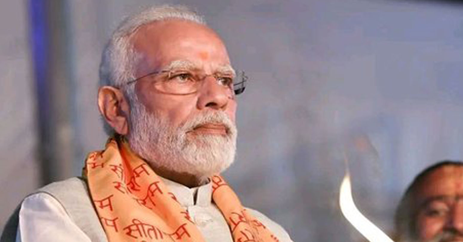
This isn't a political map: S. Jaishankar
India's External Affairs Minister, has stated that the map of 'Akhand Bharat' shown in the country's new parliament building is not a political matter. He stated that the description of India was comprehended by the adjacent nation Nepal. Jaishankar made this remark in answer to a journalist's inquiry regarding the rallies in Nepal and Bangladesh over the mural. "This map reflects the expansion of Ashoka's empire," he added. Is the description the same for Nepal and Pakistan? In answer to a follow-up question from the journalist, he stated, 'I don't think this is a political matter. Allies recognized this. Pakistan does not deserve to comprehend this. "Our friendly neighbors will understand," he remarked. They reportedly approved our description. I don't expect Pakistan to comprehend, and I have no faith in Pakistan.
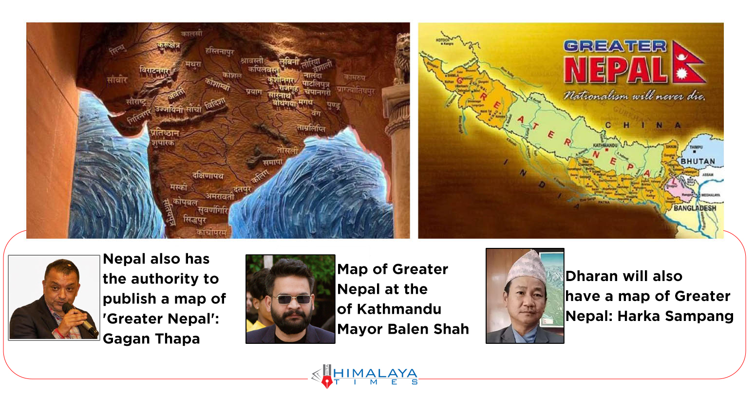
Nepal also has the authority to publish a map of 'Greater Nepal': Thapa
Gagan Thapa, General Secretary of the Nepali Congress, has stated that Nepal may also construct a map of "Greater Nepal." General Minister Thapa stated that if a country creates a cultural map, Nepal may create a Greater Nepal map as well. "If any country moves forward by making a cultural map, Nepal also has the authority to conceive a map of Greater Nepal" he said, adding that "India must not worry if Nepal is using its authority and ideas." He reinstated that Limpiyadhura and Lipulek falls under Nepalese territory. Thapa stated that Nepal should not consider any other options.
Map of Greater Nepal at the office of Kathmandu Mayor Balen Shah
Balendra Sah ‘Balen’, Mayor of Kathmandu Metropolitan City, has placed a map of Greater Nepal in his office. While India's new parliament building features a map of 'Akhand Bharat' that includes Nepal's territory, Shah's office features a map of Greater Nepal. While Mayor Shah is in India, a new map was installed in the mayor's office on Thursday. He had directed that the map be kept before departing for India. Nepal's territory used to extend from the Teesta River in the east to the Sutlej River in the west.
Dharan will also have a map of Greater Nepal: Sampang
Dharan sub-metropolitan city mayor Hark Sampang has also stated that he will also place similar map at his office. Mayor Sampang, posting a tweet, informed that a map of Greater Nepal will be kept at his office. “Dharan will now also keep the map of Greater Nepal,” the post reads.
Nepal used to extend from the Teesta River in the east to the Sutlej River in the west. During the Sugauli Treaty with British India, Nepal lost those areas.